![](/images/other/stat-length.png)
![Trail Walking La Tour-d'Aigues - la tour d'aigues - Photo](https://media.geolcdn.com/t/1900/400/ext.pjpeg?maxdim=2&url=https%3A%2F%2Fservices.sitytrail.com%2FGeolivesWS%2FDownloadMedia.ashx%3FTrailID%3D824226%26Media%3Dfix__20170906135124.jpg)
la tour d'aigues
phil331
User
![Length](/images/other/stat-length.png)
Length
15.9 km
![Max alt](https://static1.geolcdn.com/siteimages/upload/files/1508320355ic_sort_altitude_max_24dp.png)
Max alt
448 m
![Uphill gradient](https://static1.geolcdn.com/siteimages/upload/files/1508320355ic_sort_den_pos_24dp.png)
Uphill gradient
343 m
![Km-Effort](/images/other/stat-length.png)
Km-Effort
20 km
![Min alt](https://static1.geolcdn.com/siteimages/upload/files/1508320355ic_sort_altitude_min_24dp.png)
Min alt
241 m
![Downhill gradient](https://static1.geolcdn.com/siteimages/upload/files/1508320355ic_sort_den_neg_24dp.png)
Downhill gradient
316 m
![Boucle](https://static1.geolcdn.com/siteimages/upload/files/16400158638029165_repeat_loop_refresh_sync_direction_icon.png)
Boucle
No
Creation date :
2018-04-16 22:24:01.451
Updated on :
2018-04-16 22:24:01.451
![Walking](https://static1.geolcdn.com/sitytour/trail-icons/101.png)
4h23
Difficulty : Easy
![Scan this QR Code to open this trail in the SityTrail application](https://capi.geolives.com/qq0zvz2zws4bq2lad0pu/sitytour/trails/824226/qr.png?size=200)
FREE GPS app for hiking
About
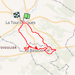
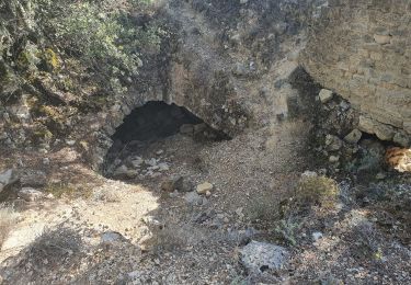
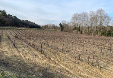
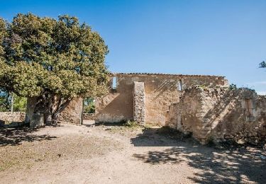
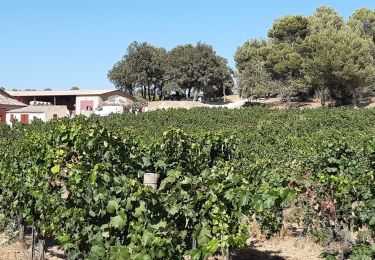
Trail Walking of 15.9 km to be discovered at Provence-Alpes-Côte d'Azur, Vaucluse, La Tour-d'Aigues. This trail is proposed by phil331.
Description
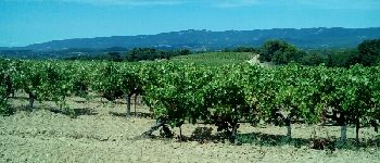
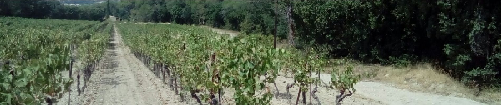
visages du Luberon Entre vignes oliveraies forêtsLa vue depuis le chapelle St Julien est magnifique. Merci à Phil84120 pour le tracé
Positioning
Country:
France
Region :
Provence-Alpes-Côte d'Azur
Department/Province :
Vaucluse
Municipality :
La Tour-d'Aigues
Location:
Unknown
Start:(Dec)
Start:(UTM)
705437 ; 4844427 (31T) N.
Comments
Trails nearby
![Trail Cycle La Tour-d'Aigues - Le Pays d'Aigues à vélo - Photo](https://media.geolcdn.com/t/375/260/ext.jpg?maxdim=2&url=https%3A%2F%2Fservices.sitytrail.com%2FGeolivesWS%2FDownloadMedia.ashx%3FTrailID%3D375429%26Media%3D99a489f7-2858-43fb-ba44-5a56cc4c2d83.jpg)
![Cycle Cycle](https://static1.geolcdn.com/sitytour/trail-icons/200.png)
Le Pays d'Aigues à vélo
Cycle
Medium
(2)
La Tour-d'Aigues,
Provence-Alpes-Côte d'Azur,
Vaucluse,
France
![](/images/other/stat-length.png)
86 km | 102 km-effort
5h 49min
![](https://static1.geolcdn.com/siteimages/upload/files/16400158638029165_repeat_loop_refresh_sync_direction_icon.png)
Yes
![Trail Walking Grambois - 2024-10-01 Grambois et les ruines des templiers - Photo](https://media.geolcdn.com/t/375/260/34aa4f0a-eb41-4073-9dd4-50b69dbe410b.jpg&format=jpg&maxdim=2)
![Walking Walking](https://static1.geolcdn.com/sitytour/trail-icons/101.png)
2024-10-01 Grambois et les ruines des templiers
Walking
Difficult
Grambois,
Provence-Alpes-Côte d'Azur,
Vaucluse,
France
![](/images/other/stat-length.png)
12 km | 16 km-effort
3h 38min
![](https://static1.geolcdn.com/siteimages/upload/files/16400158638029165_repeat_loop_refresh_sync_direction_icon.png)
Yes
![Walking Walking](https://static1.geolcdn.com/sitytour/trail-icons/101.png)
PF-La Tour d'Aigues - La Bastidonne - La Chapelle St Julien
Walking
Medium
La Tour-d'Aigues,
Provence-Alpes-Côte d'Azur,
Vaucluse,
France
![](/images/other/stat-length.png)
14.7 km | 18.8 km-effort
4h 45min
![](https://static1.geolcdn.com/siteimages/upload/files/16400158638029165_repeat_loop_refresh_sync_direction_icon.png)
Yes
![Trail Mountain bike La Bastidonne - La Bastidonne 2015 - Photo](https://media.geolcdn.com/t/375/260/ext.jpg?maxdim=2&url=https%3A%2F%2Fstatic1.geolcdn.com%2Fsiteimages%2Fupload%2Ffiles%2F1524743154velo.jpg)
![Mountain bike Mountain bike](https://static1.geolcdn.com/sitytour/trail-icons/202.png)
La Bastidonne 2015
Mountain bike
Medium
(1)
La Bastidonne,
Provence-Alpes-Côte d'Azur,
Vaucluse,
France
![](/images/other/stat-length.png)
24 km | 28 km-effort
1h 51min
![](https://static1.geolcdn.com/siteimages/upload/files/16400158638029165_repeat_loop_refresh_sync_direction_icon.png)
Yes
![Trail Walking La Tour-d'Aigues - la tour d aigues la bastidonne - Photo](https://media.geolcdn.com/t/375/260/a6ede015-e8f8-4fd7-91d3-0d454d18b365.jpg&format=jpg&maxdim=2)
![Walking Walking](https://static1.geolcdn.com/sitytour/trail-icons/101.png)
la tour d aigues la bastidonne
Walking
La Tour-d'Aigues,
Provence-Alpes-Côte d'Azur,
Vaucluse,
France
![](/images/other/stat-length.png)
14.2 km | 18.1 km-effort
4h 7min
![](https://static1.geolcdn.com/siteimages/upload/files/16400158638029165_repeat_loop_refresh_sync_direction_icon.png)
No
![Trail Walking La Tour-d'Aigues - Vignes du Château de la Dorgonne - Photo](https://media.geolcdn.com/t/375/260/99d53b3f-ad8c-4fd6-a9d1-394e59e3537b.jpg&format=jpg&maxdim=2)
![Walking Walking](https://static1.geolcdn.com/sitytour/trail-icons/101.png)
Vignes du Château de la Dorgonne
Walking
Very easy
La Tour-d'Aigues,
Provence-Alpes-Côte d'Azur,
Vaucluse,
France
![](/images/other/stat-length.png)
6.3 km | 8.1 km-effort
1h 32min
![](https://static1.geolcdn.com/siteimages/upload/files/16400158638029165_repeat_loop_refresh_sync_direction_icon.png)
Yes
![Trail Walking La Motte-d'Aigues - Étang de la Bonde - Photo](https://media.geolcdn.com/t/375/260/ext.jpg?maxdim=2&url=https%3A%2F%2Fservices.sitytrail.com%2FGeolivesWS%2FDownloadMedia.ashx%3FTrailID%3D873376%26Media%3Dfix__20171208143802.jpg)
![Walking Walking](https://static1.geolcdn.com/sitytour/trail-icons/101.png)
Étang de la Bonde
Walking
Very easy
La Motte-d'Aigues,
Provence-Alpes-Côte d'Azur,
Vaucluse,
France
![](/images/other/stat-length.png)
3.1 km | 3.6 km-effort
40min
![](https://static1.geolcdn.com/siteimages/upload/files/16400158638029165_repeat_loop_refresh_sync_direction_icon.png)
Yes
![Trail Walking La Tour-d'Aigues - La tour d'Aigues - Photo](https://media.geolcdn.com/t/375/260/ext.jpg?maxdim=2&url=https%3A%2F%2Fstatic1.geolcdn.com%2Fsiteimages%2Fupload%2Ffiles%2F1553511878bg_sport_marche.png)
![Walking Walking](https://static1.geolcdn.com/sitytour/trail-icons/101.png)
La tour d'Aigues
Walking
Easy
(1)
La Tour-d'Aigues,
Provence-Alpes-Côte d'Azur,
Vaucluse,
France
![](/images/other/stat-length.png)
14.4 km | 18.2 km-effort
3h 59min
![](https://static1.geolcdn.com/siteimages/upload/files/16400158638029165_repeat_loop_refresh_sync_direction_icon.png)
Yes
![Trail Cycle La Tour-d'Aigues - La Tour Cucuron - Photo](https://media.geolcdn.com/t/375/260/ext.jpg?maxdim=2&url=https%3A%2F%2Fstatic1.geolcdn.com%2Fsiteimages%2Fupload%2Ffiles%2F1524743154velo.jpg)
![Cycle Cycle](https://static1.geolcdn.com/sitytour/trail-icons/200.png)
La Tour Cucuron
Cycle
Easy
(1)
La Tour-d'Aigues,
Provence-Alpes-Côte d'Azur,
Vaucluse,
France
![](/images/other/stat-length.png)
27 km | 32 km-effort
1h 50min
![](https://static1.geolcdn.com/siteimages/upload/files/16400158638029165_repeat_loop_refresh_sync_direction_icon.png)
Yes